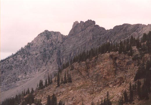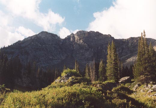
Devil's Castle is the dark, rugged peak that sits beyond popular Albion Basin at Alta ski resort. Unlike nearby Sugarloaf Mountain and Mount Baldy, Devil's Castle is not a walk-up, but rather a difficult, exposed scramble. The mountain has several summits, with the middle peak apparently being the highest. Because of the high starting elevation and short approach, Devil's Castle can easily be climbed by confident scramblers in half a day.
Beginning from Albion Basin, the standard route is to follow the popular trail to Cecret Lake, then a more faint, and definately more steep trail to the ridge between Sugarloaf and Devil's Castle. From here one proceeds east on a faint trail towards the summit, and the ridge soon becomes an exposed scramble just before the first peak. I first climbed Devil's Castle in 1997 with John via this route. We ascended the first peak by way of the crack described in Veranth's book on the north side of the mountain, after traversing mostly on the south side. The crack had some serious exposure! We stopped on the first peak, which according to Veranth's book most people do, but it appeared fairly obvious both the middle peak and easternmost peak were both higher. While we sat on the first peak, a huge golden eagle circled above us, then proceeded to land on the eastern peak. Upon hearing fairly conclusive evidence that the further peaks were indeed higher in recent years, I knew it was time to go back, and simply traverse the whole ridge.
Because of the rugged nature of Devil's Castle, this was hardly a climb I wanted to attempt alone, so I went with the Wasatch Mountain Club, as I often do on more difficult climbs. On this climb there were just three of us- myself, Al (the hike leader) and Brett. After a slow drive up the canyon road due to a bike race, we arrived at Albion Basin around 9am. Instead of hiking the standard trail to Cecret Lake, Al took us on a longer, looping trail that went well east underneath Devil's Castle before circling back to the lake. He dubbed this trail "Moose Alley" and it didn't disappoint...as we walked through one meadow there were two full-size bull moose just sitting in the weeds. I took a picture of both of them, but due to them not standing up, the picture doesn't do justice to what it was like to be there and see them in person. Soon we joined the trail leading up to the saddle between Sugarloaf and Devil's Castle, just above Secret Lake.
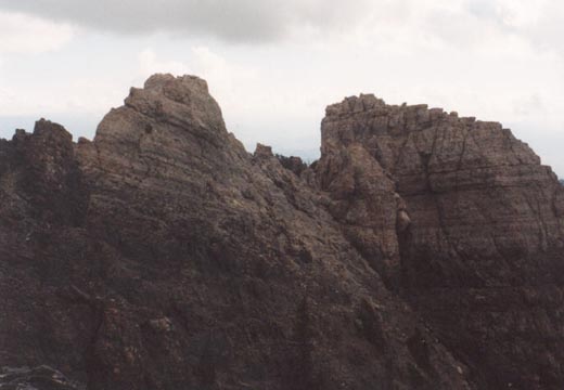
The trail leading up to the saddle is full of steep switchbacks, but was in better shape than I had remembered it the last time I was here (in 1999), which was a welcome sight. As we approached the ridge at about 10,750 feet dark clouds lingered above and I hoped the weather would hold as this ridge was hardly the place to be in a storm. After a short break, we proceeded towards Devil's Castle. Much like the trail we had just come up, the trail leading to the first peak was much better than in 1997 when I came up with John, and the trail was in fairly good shape all the way to a sudden 40 foot cliff just before the first summit. I believe this is the cliff John and I climbed on the north side in '97, but this time we climbed up a chute facing directly west. One thing about Devil's Castle is that the rock is generally very solid and very knobby, making for thoroughly enjoyable scrambling. This chute did have one spot however with loose rock that was pretty intimidating given the drop below. Once past this we arrived on the wide, rocky first peak. From here one has an ominous view to the higher middle and east peaks.
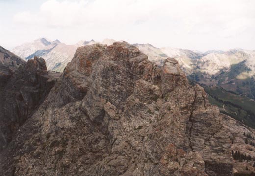
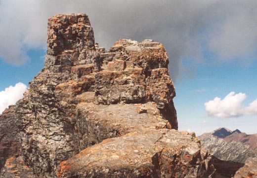
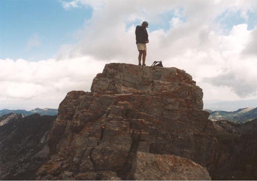
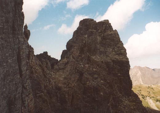
As bad as it looks, the scramble to the middle and east peaks wasn't as intimidating as I had expected. We continued past the middle peak (which can be summited from a variety of directions, probably easiest from some slabs just east of the summit) to the very exposed gap between the middle and east peak. The exposure and views here are sensational! While this east peak looks impossible from a distance, as you get closer it isn't as steep as it looked, and it is obvious that there is a ledge system you can climb up onto that goes south to the main ridge, where you can walk back north to the top. Nevertheless, the climbing is still quite exposed and an accident would be severe, if not fatal. Once on the third peak there is a stunning view back to the peaks and ridge that you just climbed across...it looks impossible! Fortunately for us, the weather had continued to hold and was nothing more than cool and overcast (a welcome change from the ridiculous heat of the summer). We took a lengthy break on this final summit and watched several mountain goats below to the east.
From here it's probably easiest to continue east rather than downclimb the dangerous route you approached from. However, even the gentler descent to the east is still steep and involves some difficult scrambling often complicated by thick shrubbery. As you descend to the east you get more incredible views of the summits you just came from, and you may wonder how you got up there! You can descend back to Albion Basin by either downclimbing to the north from the first peak beyond Devil's Castle, or as we did, continue further east and downclimb a steep hillside just before an un-named 10,864 foot peak. Either route down is steep at first, but compared to what you've just climbed, it should give you no problems. Once back on the Alta service roads, continue back past campsites to the parking area. The total vertical climb of Devil's Castle is probably about 1,700 feet given a few extra ups and downs, four to five miles depending on exact route taken, and took us just over four hours of climbing time. It is one of, if not the best "bang for the buck" peak in the Wasatch.