Our original plan for this hike was to climb Flat Top Mountain (10,620ĺ), the highest peak in the Oquirrh Mountains, the range that makes up the west side of the Salt Lake Valley. The Oquirrhs are not the easiest peaks to access due to private property, and for that reason sit pretty well neglected compared to the Wasatch. Our route was to drive to the tiny town of Ophir, and walk a three mile long 4WD dirt road (as neither Allen or I have a high clearance vehicle) up to a pass on Lewiston Peakĺs west ridge at 8,060 feet. From here a trail of sorts was to lead us up Lewiston (10,411ĺ) where we could walk the ridge the additional half mile to the slightly higher Flat Top, the monarch of the range.
The hike started off well enough in that we arrived in Ophir slightly before 8am. Just as the dirt road is interrupted by a pretty swift stream (this year at least), there is a spot to park. We got our gear ready and headed up the dirt road, crossing the stream. We missed the proper turn off somehow, and walked about 10 minutes too far up Ophir Canyon and had to do some back-tracking and make another stream crossing to get on the right dirt road. Once on the correct road, it was simple walking up the road, save the occasional encounter with cattle which are all over these mountains. After about a mile and a half we came to a nice meadow where the road splits. Left leads to Halls Basin, a desirable route to take to Flat Top, but that is private property. We took the right fork which lead us another mile and a half or so to the pass at 8,060 feet.
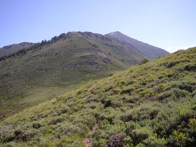
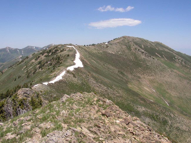
Our arrival at the pass was made all the more interesting by a baby cow that we couldnĺt get rid of. Most of the cows run from you, but not this one, and it made me nervous that this babyĺs interest in us might just anger the parent! Finally it left us alone and we could continue. The road forks and we headed left up Lewiston Peakĺs obvious west ridge. Immediately the road died, and there was no sign of a trail! Disappointed, we continued straight up the steep hillside which got tiring very quickly. After a few hundred feet low and behold, trail! Somehow we had missed the start down lower, as the trail was quite clear and easy to follow once on it. We criss-crossed up the slope finally swinging north around a minor peak of about 9,150 feet. The views were nice and we could see Lowe Peak (10,589ĺ) to the north with a few slivers of snow remaining.
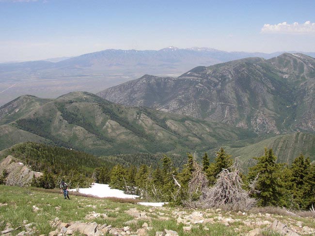
The terrain levels out briefly before beginning the final haul up Lewiston. After climbing a few hundred feet, the trail was heading north, far more than we really wanted to go, so we opted to backtrack again and head straight up Lewistonĺs west ridge on the fragaments of trail that existed. The vegitation was pretty thick in some spots, and small cliffs made it impossible to use the south side of the ridge, where vegitation would be less. Whatĺs more the ridge was simply very steep! At several points I considered abandoning the climb, partly out of poor conditioning, and partly out of the constant guilt I generally feel hiking on a weekend while my wife is at home taking care of Brady. Nevertheless, we continued. A couple of large snow patches made it a little more interesting just before the top. At the top we were greeted with fine views back east towards the Wasatch, where tremendous amounts of snow could still be seen in the Cottonwood Canyons, on Timpanogos, and particularly Mt. Nebo far to the south. The Oquirrhs seemed to have considerably less snow though some patches still lingered on the ridges and on north facing slopes. Flat Top looked so close I felt I could just reach out and grab it, but it was already 12:30 (30 minutes beyond my anticipated summit time), and a long descent, and a long drive home still awaited me. Besides that I was exhausted and a little woozyůnext time, bring the 4WD vehicle and eliminate the long approach!
The summit register on Lewiston had few signatures (mostly hunters), and an old cell phone which didnĺt seem to work. We didnĺt stay long as the flies were thick on this day. The trip down started out pretty well despite our fatigue as the snowfields made the first 400 feet of descent pretty easy. From here out, the hike down was slow and miserable. We had hoped to maybe hitch a ride from the pass back down the 4WD road, but everyone we passed was going up. We made it back to Allenĺs car at 3:45, making the hike just under eight hours. Stats were about 10.5 miles RT with a gain of around 3,800 feet. Definitely a one timer hike, and the only way Iĺd go back to get Flat Top is if I had a ride to the pass at 8,060 and could start the hike from there.