Sessions Mountain
Elevation: 9,240+
Location: Wasatch Range, Utah
 Sessions Mountain is a very unknown peak in the northern Wasatch near Bountiful. From just
about anywhere north of Bountiful it is almost impossible to see, but from parts of Bountiful
and North Salt Lake it is very prominent as a high, nearly perfect triangular peak just north
of the Muellar Park area. Topo maps don't give it an exact height, but it appears to be 9,240+.
Sessions Mountain is a very unknown peak in the northern Wasatch near Bountiful. From just
about anywhere north of Bountiful it is almost impossible to see, but from parts of Bountiful
and North Salt Lake it is very prominent as a high, nearly perfect triangular peak just north
of the Muellar Park area. Topo maps don't give it an exact height, but it appears to be 9,240+.
There are basically two routes that one could take to climb to Sessions Mountain. One is to
drive the Bountiful Peak road (Skyline Drive) up to the ridgeline at 8,100 feet to a parking lot. A jeep
road heads south for four miles to the start of the Great Western Trail. Sessions can be climbed
by a slight detour from this trail. A shorter but steeper route ascends from the Muellar Park
area via Kenney Creek. In the peak of summer heat, I opted for the high elevation start along
the Bountiful Peak road.
Passenger cars should have no problems driving up the main Bountiful Peak road, but be sure to
be cautious and let faster moving vehicles by if possible. Access this road by driving up past homes
near the huge "B" on the mountainside. The road switches back and forth for nearly eight miles to the
ridgeline at 8,100 feet. I reccomend cars park here. Passenger cars could drive part of the road
south, but with limited space to park I don't reccomend it. 4x4 vehicles can drive to a large open area
four miles down the road and start from there, making it a very short hike.
It is about four miles of walking this road to get to the Great Western Trail. At a clearing the road
dips down about 100 feet. Head right at the bottom of the hill through some trees and you'll see the
start of the Great Western Trail (of course, sign has been vandalized and is gone, but a post still
stands). On weekends, do not expect solitude along the road, it is a popular place.
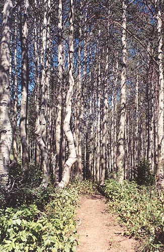 The trail switches back and forth for a few hundred feet through thick forest (including an impressive
stretch of aspen trees) before gaining the rige at about 9,000 feet. Here Grandview Peak comes into
view across a valley to the south. A bland ridge leads up west, and this is where you want to go. There
is no trail, but it is easy walking. The first major peak you come to is the true summit. It is about a
15 minute easy ridgewalk to the slightly lower west peak (the point of the triangle visible from Bountiful
and North Salt Lake). This peak offers much better views of the valley below.
The trail switches back and forth for a few hundred feet through thick forest (including an impressive
stretch of aspen trees) before gaining the rige at about 9,000 feet. Here Grandview Peak comes into
view across a valley to the south. A bland ridge leads up west, and this is where you want to go. There
is no trail, but it is easy walking. The first major peak you come to is the true summit. It is about a
15 minute easy ridgewalk to the slightly lower west peak (the point of the triangle visible from Bountiful
and North Salt Lake). This peak offers much better views of the valley below.
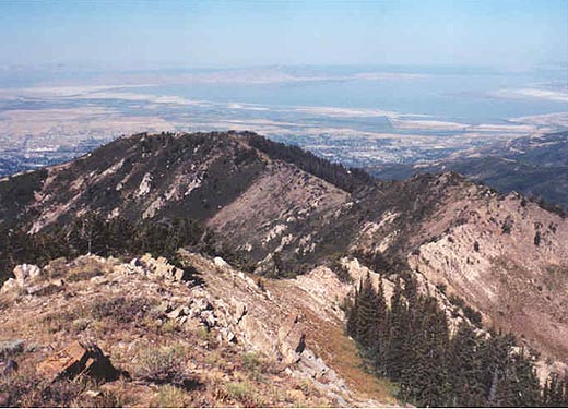
To the north are Bountiful Peak and Francis Peak (obvious from it's radar domes). To the east on a
clear day you can make out some of the westernmost Uinta peaks around Mirror Lake. South is the
slightly higher Grandview Peak and it's long ridge heading west. You'll get a good view down into
the Muellar Park area that few people ever see. The high peaks of the Salt Lake area pop up behind
Grandview's west ridge, as do the Oquirrh range peaks out to the southwest. While the road is a popular place,
the summit area is not, as there wasn't even a cairn or mailbox.
It is about 5.5 miles and 1,500 feet to climb Sessions Mountain from this route. The hike takes about five
or six hours roundtrip. It was not an outstanding hike, but it was worth doing once.